
Where are the fires in Oklahoma right now? Track wildfires with interactive map.
Wildfires in Oklahoma have now burned more than 300,000 acres of land across the state after crews worked to contain fires in the Panhandle on into Wednesday, according to state officials.
According to the Oklahoma Department of Emergency Management, Beaver, Woodward and Texas counties remain the main areas of danger. The three counties are also under a state of emergency.
Because of the damage to agricultural land, the Oklahoma Cattlemen’s Foundation has established a Fire Relief Fund to support cattle producers impacted by the recent wildfires on its website.
In addition, the Oklahoma Department of Agriculture, Food and Forestry recommends any affected livestock producer contact their county Farm Service Agency.
Across the three counties, these are the estimated damages from this week’s wildfires:
Ranger Road Fire (Beaver County / Kansas): 283,283 Acres – 15% Contained
Stevens Fire (Texas County): 12,428 Acres – 50% Contained
Side Road Fire (Texas County): 3,680 Acres – 60% Contained
43 Fire (Woodward County): 1,680 Acres – 30% Contained
206 Road Fire (Woodward County): 160 Acres
While most activity has been spotted in the northwest, Oklahoma remains under a Red Flag Warning.
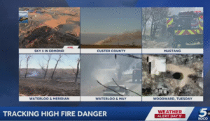
On Wednesday, the ODEM reported 33 fires and 23 hotspots in the following additional counties: Atoka, Beckham, Blaine, Bryan, Carter, Coal, Custer, Garvin, Hughes, Kay, Lincoln, Logan, Love, Marshall, Mustang, Oklahoma, Okmulgee, Pontotoc, Pottawatomie, Stephens, Tillman, Woods, and Woodward.
On Thursday, many of the central parts of Oklahoma are under the threat of fire danger, according to the National Weather Service.
What is a red flag warning?
Red Flag Warnings are issued when there are critical fire conditions either actively occurring or starting shortly. Conditions like strong winds, low relative humidity and warm temperatures all contribute to extreme fire behavior.